1
/
of
7
Source Unknown
VTG “Graveyard of the Atlantic” NC Lighthouses, Pro-Framed Double‐Matted 20"x11"
VTG “Graveyard of the Atlantic” NC Lighthouses, Pro-Framed Double‐Matted 20"x11"
Regular price
$49.97 USD
Regular price
$0.00 USD
Sale price
$49.97 USD
Unit price
/
per
Shipping calculated at checkout.
Low stock: 1 left
Couldn't load pickup availability
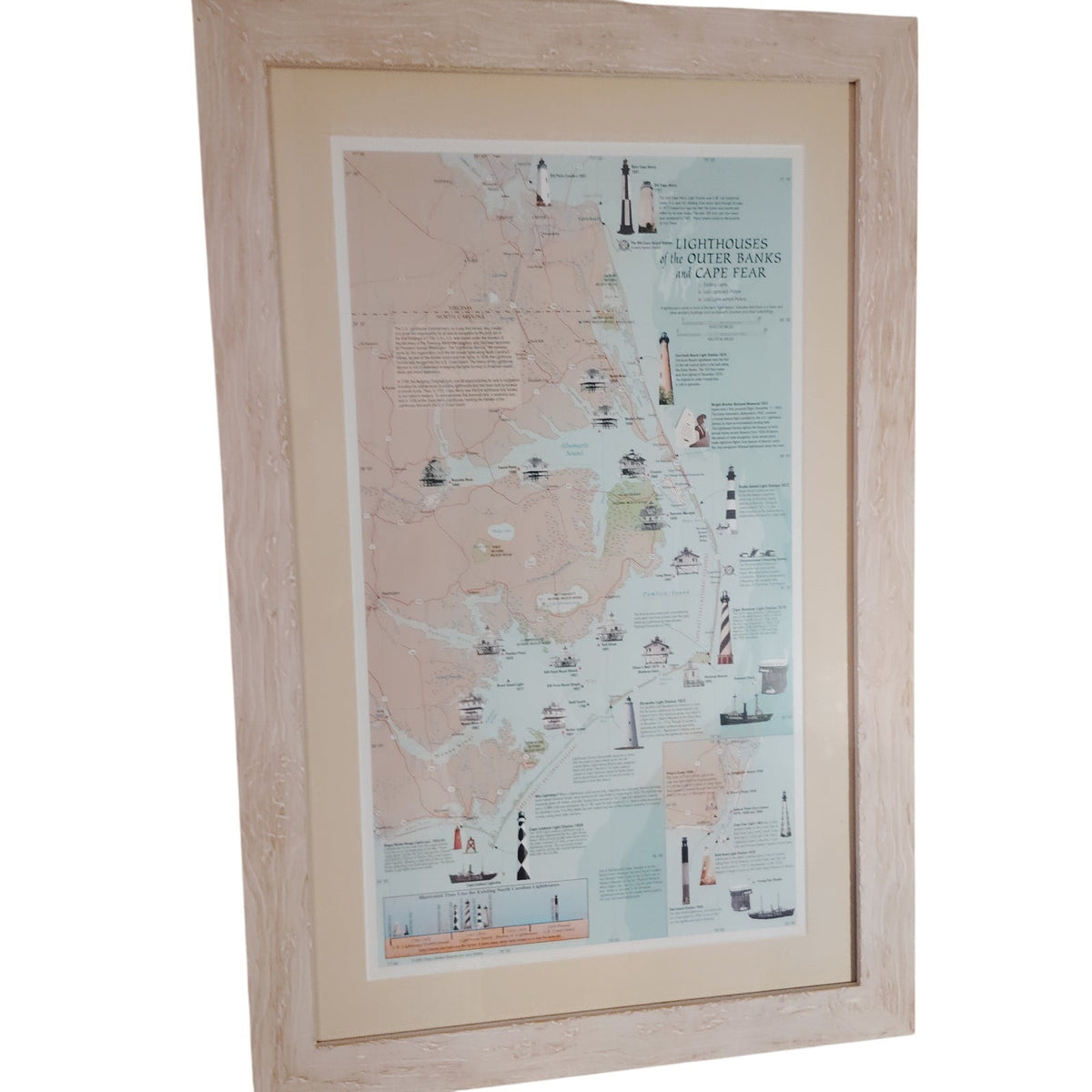
• Framed map print titled "Lighthouses of the Outer Banks and Cape Fear" for coastal wall art.
• Distressed whitewashed wood frame, cream mat, and glass front; back wire hanger for easy display.
• Pale blue ocean, tan land, and red roads with lighthouse illustrations and historical text.
• Blue and beige nautical palette suits beach house, cottage, or study decor.
• Outer Banks and Cape Fear lighthouse map covering Currituck, Hatteras, Ocracoke, and Cape Fear.
• Pre-owned, excellent condition.
16.75"W x 25.5"H Overall. Poster within is 11"W x 19.5"H
This is a beautifully preserved, professionally framed illustrated map chart depicting the historic lighthouses of North Carolina’s infamous “Graveyard of the Atlantic.” Purchased in 2001 and now 25 years old, the piece remains in pristine condition thanks to careful preservation under glass and a premium double‑mat presentation inside a textured white‑washed wood frame.
Historical & Design Elements
The Subject:
This classic illustrated map highlights the treacherous North Carolina coastline long known as the “Graveyard of the Atlantic,” a region notorious for centuries of shipwrecks, storms, and maritime navigation hazards.
The Beacons:
The chart features detailed illustrations and daymark patterns of North Carolina’s most iconic lighthouses, including:
Cape Hatteras (black‑and‑white spiral)
Cape Lookout (black‑and‑white diamond pattern)
Bodie Island (horizontal banding)
Ocracoke Light
Old Baldy and other Cape Fear River lights
It also references historic screw‑pile lights that once dotted the sounds and inlets.
Educational Details:
Inset panels provide technical and historical information such as:
focal heights
years built
light characteristics (flashing patterns)
structural histories
active vs. decommissioned lights
This makes the piece both visually striking and educational — ideal for coastal décor, lighthouse collectors, or anyone with ties to the Outer Banks.
Sourcing & Collectibility
These illustrated lighthouse charts were popular regional prints sold in:
coastal museum gift shops
national park visitor centers
Outer Banks maritime galleries
East Coast lighthouse preservation society shops
Share